Eagley Brook once powered part of Bolton’s industrial revolution and was heavily polluted. Now the area is returning to nature with plenty of industrial remains hiding amongst the foliage.
The brook flows out of Belmont Reservoir - named on the map as Belmont or Eagley Brook, until after Longworth Clough with its sprawling old paper mill the confluence with Delph Brook is reached and the river becomes Eagley Brook. After the village of Eagley the river bends toward Bolton and flows through a series of sharp bends with steep sides, Eagley Brook flows into the River Tonge.
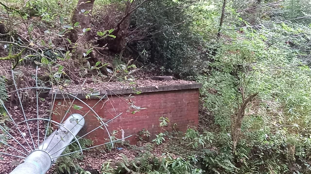
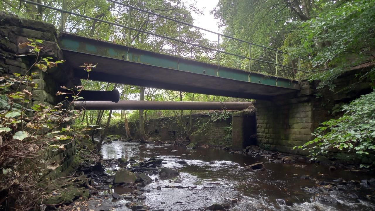
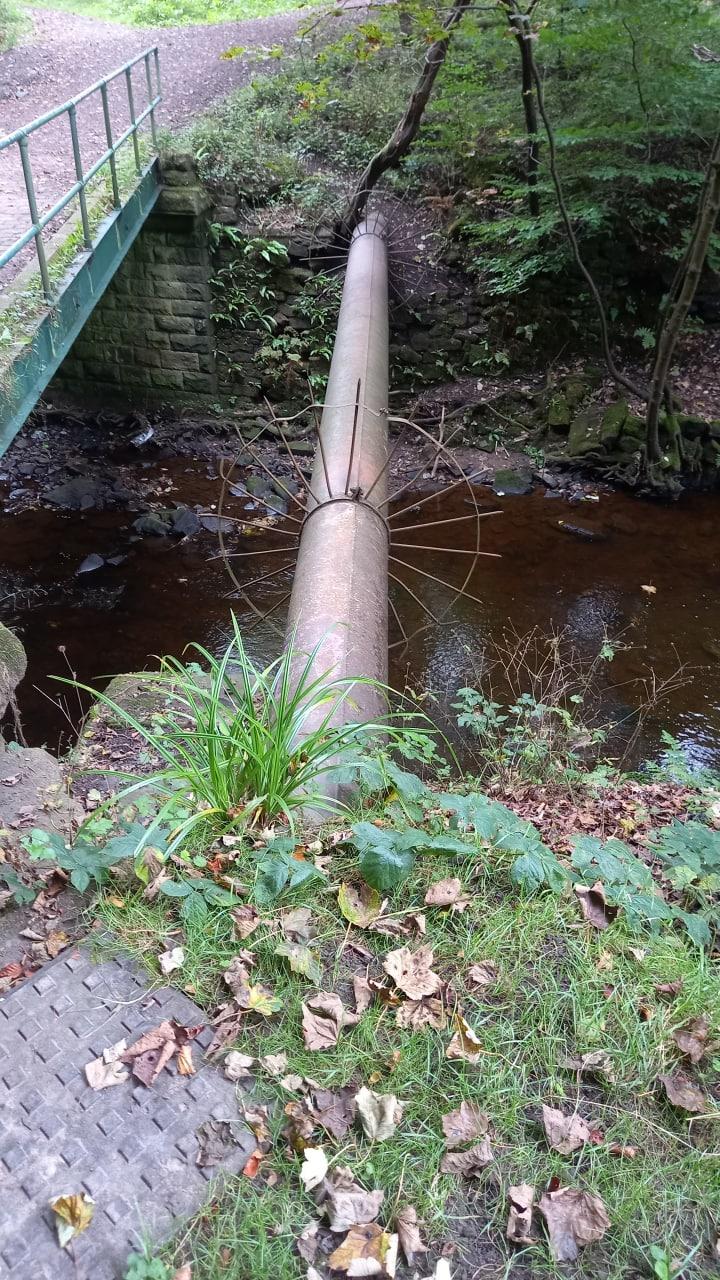
An interesting section of Eagley Brook for industrial remains can be found as the brook heads towards Birtenshaw where a foot bridge now crosses beneath the giant rocky cliff of Eagley Shore. On the northern bank of Eagley Brook is the site where the Eagley Foundry and Paper Mill once stood, now landscaped back to grassy parkland. Along the river, downstream of the bridge were two linear reservoirs supplying water to the New Eagley Mill built by John Ashworth in 1802, near Bank Top. Various sluices and mill races can be found beside the now empty reservoir channels along with large metal sluices and huge stone blocks in disarray across the river bed. There was in the early 20th Century a sewage works on the southern bank of the brook just downstream of Eagley Shore with filter beds so this is probably the reason for various iron pipes over the river along the way, a brick building covered in graffiti is also mentioned in the turton history society book, which is connected with old eagley sewage works but I have yet to find this, and I fear it may have been demolished.
Down in the Eagley Brook on the north shore a old mine drain can be seen depositing orange coloured, iron “ochre” into the brook. The mine drain near the end of the old reservoir mill-race, is probably a tunnel from the coal shafts up on the hill at Birtenshaw.
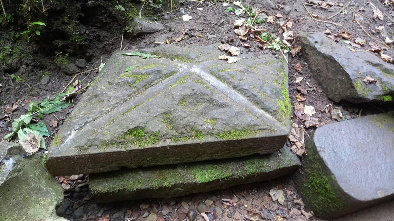
On the east side of the Eagley Brook below Strawberry Brow, further downstream there is an old stone covered spring, with strange stone shelves inside and what looks to be a small trough. Old OS maps show either a spring or a well on the spot. Elements of the stonework include large stone flags, seemingly out-of-place with the more modern looking patches of dressed blocks. Two large slabs on the ground have iron fittings as though they were once stone doors. There is a solitary stone gable in the trees nearby without any other walls, a central doorway is blocked by presumably its old iron gate now horizontal. Down in the stream beyond a weird overflow or drain enters a triangular concrete weir - hope that one isn’t for the sewers.
It’s an interesting walk down the river and back along the other side, some litter and bits of graffiti but it’s nice to see nature slowly taking over.